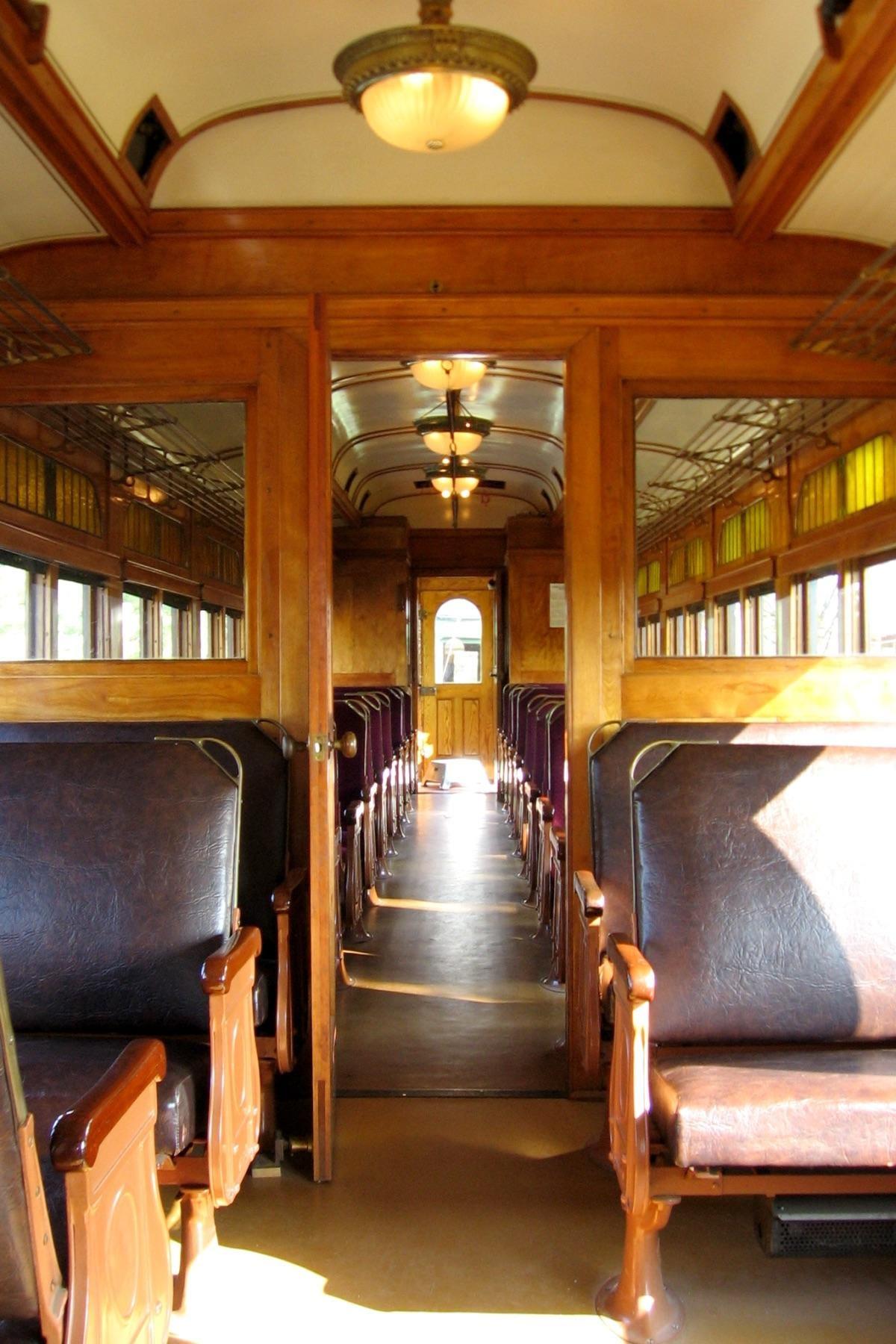
Picture this: hopping on a streetcar at Dundas and Richmond, gliding smoothly through downtown London, and ending up at Port Stanley for an evening by the lake. Sounds like a dream, right? Well, it was actually reality for Londoners over 80 years ago.
A recent discussion on the London Ontario subreddit has reignited local curiosity about the city’s forgotten streetcar system, with residents debating whether ditching the rails was London’s biggest transportation mistake.
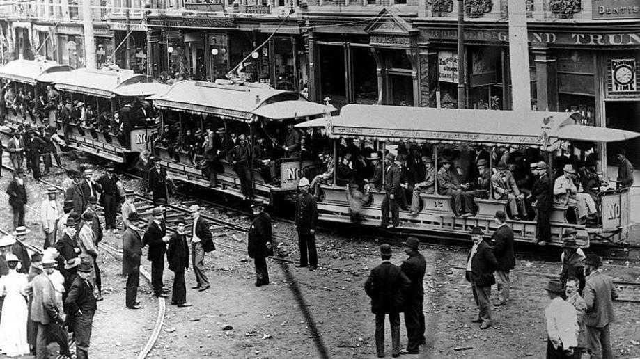
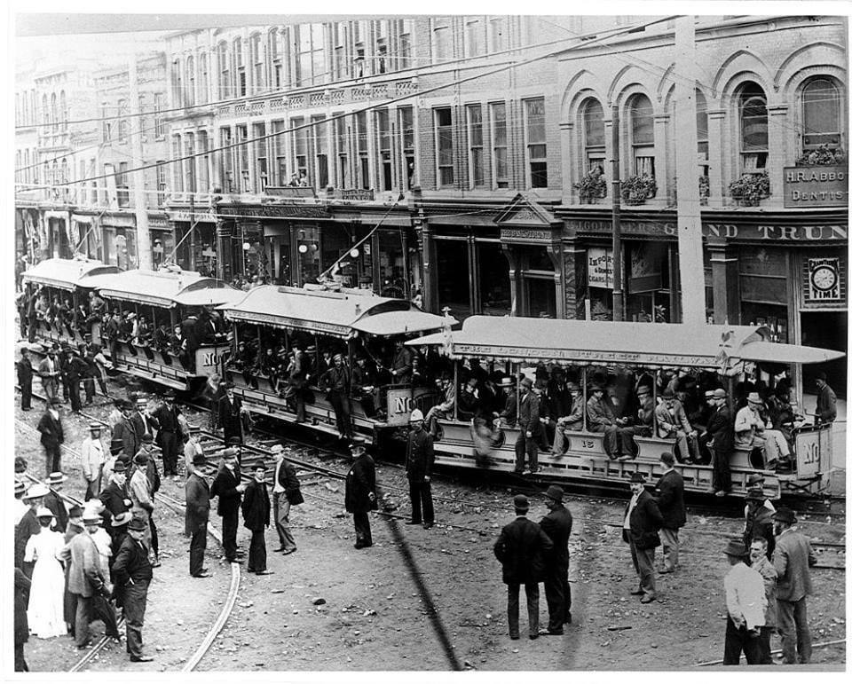
London’s streetcar network was no small operation. The system once connected the downtown core to neighbourhoods across the city, with one particularly impressive route stretching all the way to Port Stanley. One Reddit user shared that their great-grandfather operated a streetcar in London and was so reliant on public transit that he never even bothered getting a driver’s licence. When the city switched to buses, he refused to adapt and became an inspector instead, standing at Dundas and Richmond with his Waltham pocket watch to ensure buses ran on time.
The streetcar era came to an abrupt end around 1940, reportedly after a massive snowstorm knocked the system out of service. But locals are questioning whether that was really the end of the story. Several residents pointed to the influence of petroleum companies and the automotive industry, suggesting that the push toward car dependency was part of a broader North American trend that prioritized roads over rails.
What’s particularly fascinating is how London’s streetcar suburbs developed. Take Wortley Village, for example – it’s essentially a perfect example of what streetcar-era urban planning looked like. The neighbourhood features a walkable shopping street surrounded by mixed-use buildings, single-family homes, schools, and low-rise apartments all integrated together. It’s the kind of community design that would actually be illegal to build today due to London’s current zoning policies.
The timing couldn’t be more relevant. London is currently grappling with traffic congestion, sprawl, and public transit challenges that have residents comparing their city unfavourably to places like Toronto (which kept its streetcars) and Kitchener-Waterloo (which recently introduced LRT). One commenter noted that London is the fourth-largest city in Ontario but ranks 20th in population density, meaning tax dollars don’t stretch as far because services have to cover more ground.
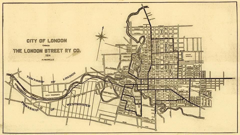
Historical maps from 1926 show just how extensive the streetcar network was, with tracks running throughout the downtown core and extending to various neighbourhoods. The London Transit Commission confirms that the streetcar system operated until 1940, well before GM started manufacturing buses in London in 1961, debunking some theories about the timing of the transition.
The conversation has locals dreaming about alternative timelines. Imagine being able to catch a 30-minute train to Port Stanley after work, or having dedicated streetcar lanes that bypass London’s increasingly frustrating traffic. Some pointed out that Kitchener-Waterloo’s LRT project actually uncovered buried sections of original streetcar tracks during construction – a literal reminder of the infrastructure that once connected communities.
While some residents argue that buses offer more flexibility than fixed rail systems, others contend that London’s car-centric development has created exactly the kind of sprawling, inefficient city that streetcars were designed to prevent. The debate touches on everything from housing density to downtown revitalization to the environmental impact of car dependency.
The discussion reveals a broader frustration with London’s current transit system, with residents regularly complaining about service reliability and coverage. Meanwhile, the city continues to grow outward rather than up, creating longer commutes and putting more pressure on road infrastructure that’s already struggling to keep pace.